Mt Tobin
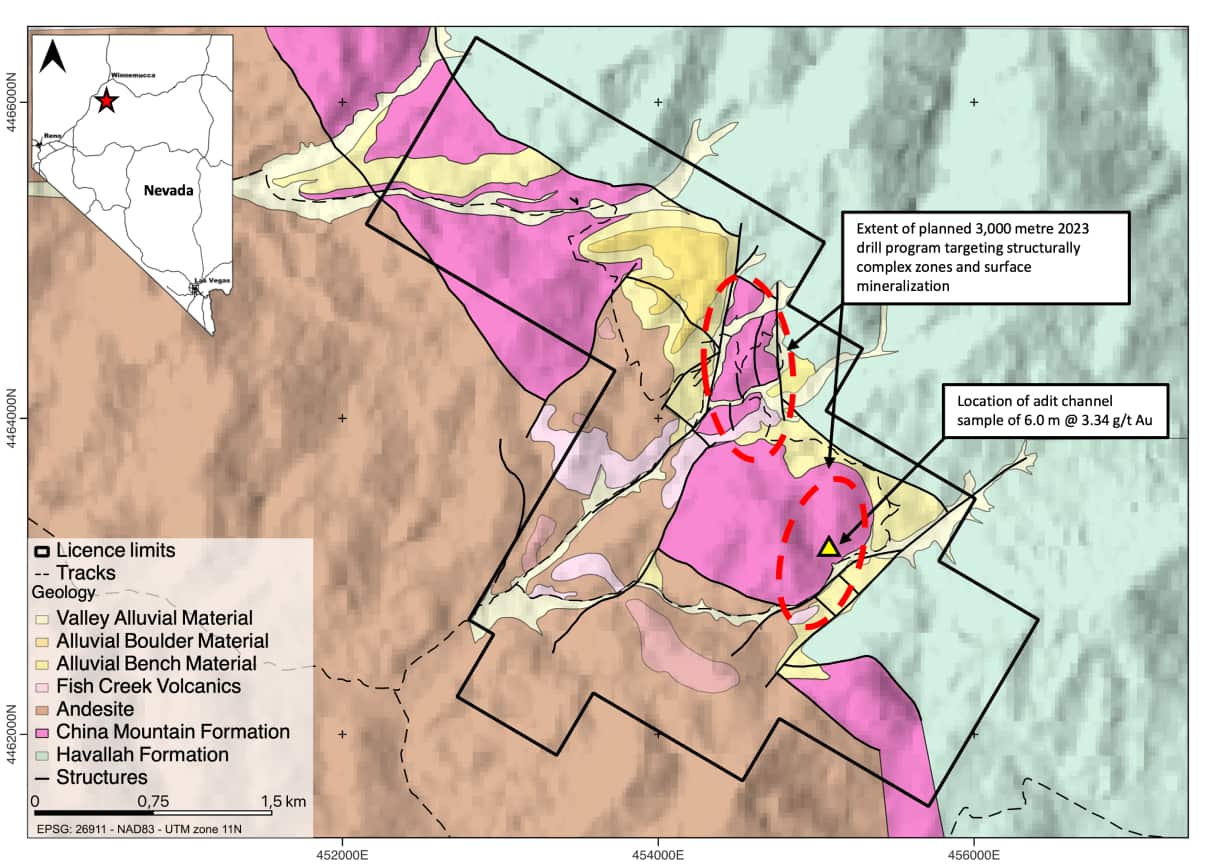
Mt Tobin is a low sulphidation epithermal gold project in Nevada with rock chip samples of up to 9.83 g/t Au. Multiple anomalous zones of pathfinder elements and alteration associated with Low Sulphidation Gold systems make compelling drill targets. Plethora Exploration plans to test the zones with 3,000 metres of drilling. The Property comprises 121 unpatented mining claims all within BLM land covering a total area of 1,012 hectares and are 100% owned by Plethora Exploration.
Overview
- Mt Tobin is a low sulphidation epithermal gold project located in Pershing County, Nevada.
- Easily accessible with good infrastructure and in a world-class mining jurisdiction.
- Field work conducted by Plethora Exploration yielded rock chip samples of up to 9.83 g/t Au and two continuous chip channel samples of 6.0 m @ 3.34 g/t Au and 1.0 m @ 8.68 g/t Au
- A soil survey and geological mapping identified multiple zones of anomalous pathfinder elements and alteration associated with Low Sulphidation Gold systems. These anomalous zones appear to be structurally complex and make compelling drill targets.
- 3,000 metres of drilling is planned to test the main zones of geochemical anomalism and the structurally complex zones at the Mt Tobin Low Sulphidation Epithermal Gold Project
Geology
- Historically known mercury district and was a past-producer from 1938-1942 but little effort was made to link the high-level mercury occurrences to a deeper gold-rich epithermal system.
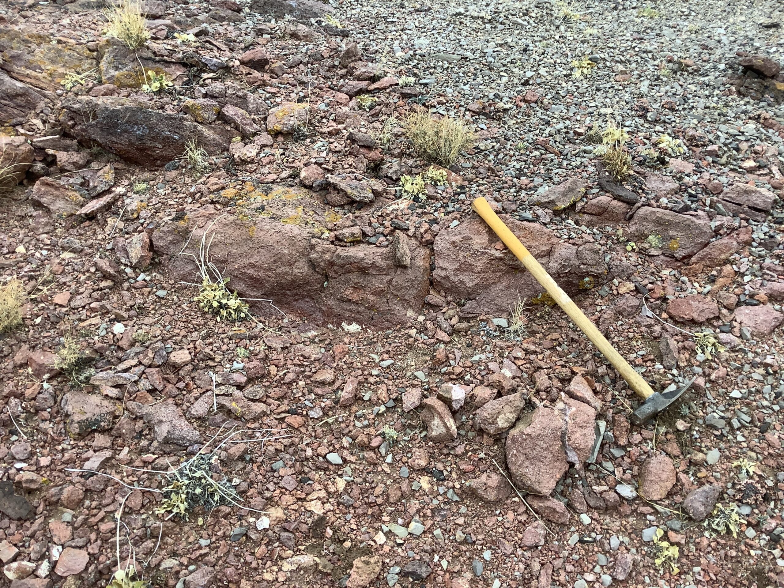
- Various high-level epithermal vein textures are observed on the property, primarily at the Rockhouse and Rockhouse West zones. High gold grades (up to 9.8 g/t Au) are associated with quartz after calcite, bladed textures.
- Gold mineralization occurs in association with open-space fill textures, such as bladed silica replacement after carbonate (i.e., evidence of boiling) and hydrothermal breccias, which suggests proximity to the palaeosurface and a low-sulfidation nature of mineralization.
- The principal structural feature is a northwest trending volcano-tectonic graben. The margin of the graben is defined by northwest trending faults that have juxtaposed the Havallah sequence against China Mountain Formation. Faults and fractures in the China Mountain Formation are numerous and some have provided the conduits for Tertiary hydrothermal fluids.
Access and Location
- Mt Tobin is situated approximately 70 km south of Winnemucca in the Central Tobin Range and lies at the northern end of the Tobin mining district within the Tobin Range.
- A county-maintained dirt road in Golcanda Canyon provides access to the western part of the study area. An improved dirt road through Bushee Creek Canyon provides access to the northern part of the district.
- All accessible via truck and ATV
Land Tenure
- The Property comprises 121 unpatented mining claims all within BLM land covering a total area of 1,012 hectares. The claims are valid until September 2023, they can be renewed on a year-by-year basis. Claims are 100% owned by Plethora Exploration.